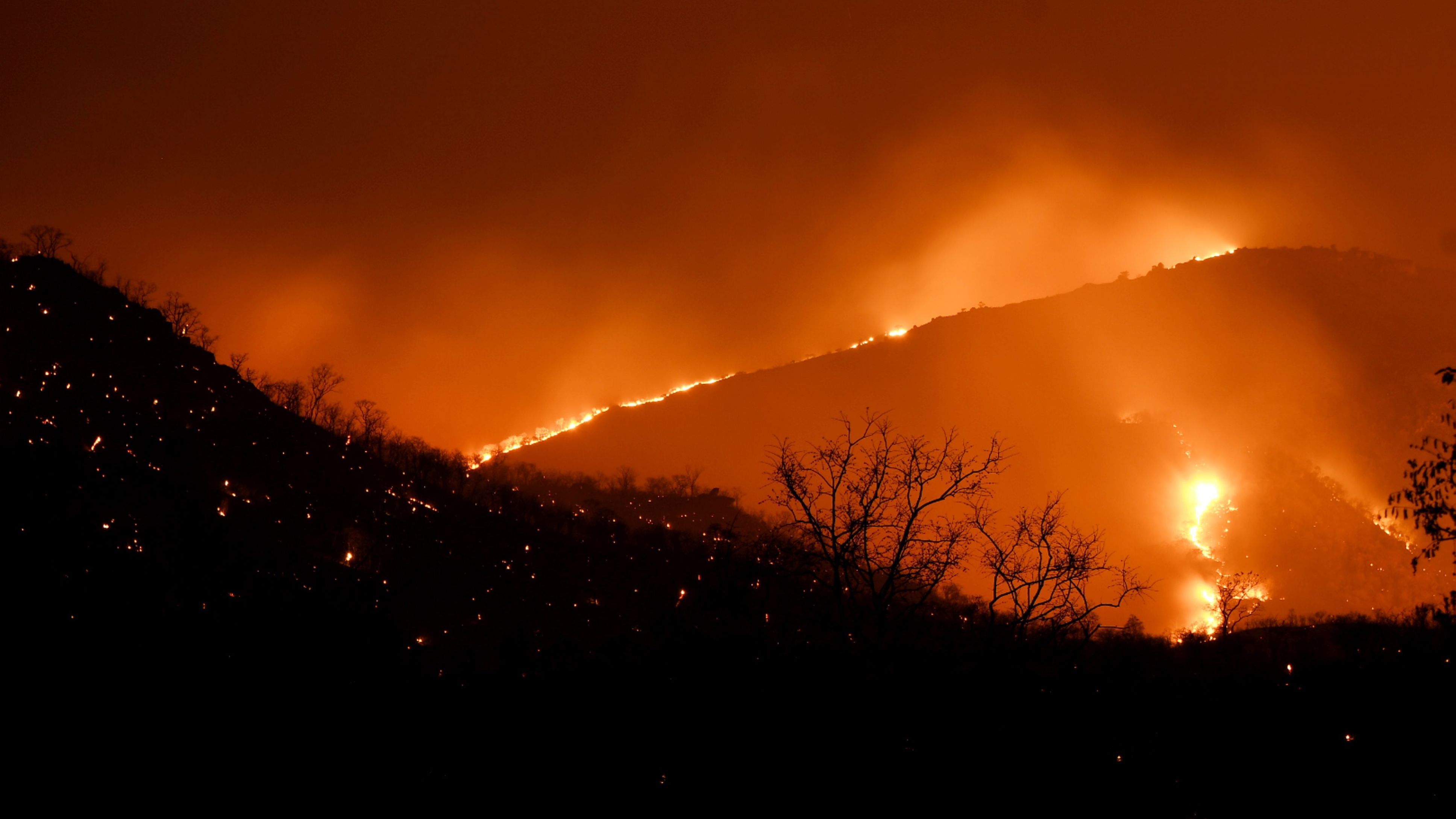
A report released by the Indian Space Research Organisation on Tuesday, 26 February, has pegged the total estimation of burnt area at nearly 4,420 hectares or approximately 10,920 acres of the Bandipur Tiger Reserve. While the fire was doused and said to be under control as of Tuesday, Karnataka forest department officials had so far maintained that the fire damage could not have affected more than 2,500-3,000 acres. Senior officials told The Quint it was the intensity of the fire, and not the areas it covered, that was important.
Every year, as part of the Disaster Management Support programme, forest fire monitoring is carried out from February to June, the report stated. Satellite data is used to prepare near real-time maps of the fire alerts which are then dispersed for the use of various departments.

-
 Indian Markets Turning Corner After Two Tough Years, Says Sandeep Tandon
-
 NDTV Profit Ignite 2026: Experts See Opportunity In Equities, Stay Bullish For Long-Term
-
 Buy Right, Sit Tight Does Not Work for Individual Stocks, Says Dinshaw Irani
-
 'Worst Is Behind': Quant MF Sees Market Bottom, Flags 'Extreme Euphoria' In Midcaps
-
 India's Mutual Fund Industry Could Become A $1 Trillion Opportunity, Say Fund Managers
-
 'Foreign Investors Are Baraatis': Raamdeo Agrawal's Take On LTCG Tax
-
 Stay Invested Through Market Cycles: Raamdeo Agrawal at NDTV Profit Ignite
-
 Ramesh Damani Remains Bullish On India For Next 20-30 Years, Sees Bargains Amid Market Weakness
-
 CAS Came After A Long Consultation Process: SEBI Chairman Tuhin Kanta Pandey AT NDTV PROFIT IGNITE
-
 Aim To Cut FPI Onboarding Time From Mth To Five Days: SEBI Chairman Tuhin Kanta Pandey AT NDTV PROFI
However, when contacted, forest department officials downplayed the extent of the damage and said that 10,000 acres was only a ‘small percentage' of the total Reserve spread over 1,320 square kilometres.
Speaking to The Quint, C Jayaram, Principal Chief Conservator of Forests said that the intensity of flames across a majority of the affected lands was only 0.1-0.2 on a scale that goes up to 0.7, in terms of fire intensity.
Also Read | Layoffs Are Rising In Tech, But These Skills Are Helping People Unlock Better Pay
“It is like saying if a human body is on fire and only the hair is singed, it is not that serious. However, if the skin is burnt, then treatment is required. Of the total, 4,900 ha that has assessed as being burnt, high intensity fire has only crossed through about 300 ha. We are planning treatment measures for those areas.”C Jayaram to The Quint
A ‘high-intensity' fire is said to be one that measures 0.3 and above on the scale. According to Jayaram, in a majority of the 10,000 acres affected, the fire has only passed through but not done major damage.
“We even sent volunteers and officials into the forest and they have also said damage is limited. We are planning for seed sowing, soil and moisture conservation in those areas.”
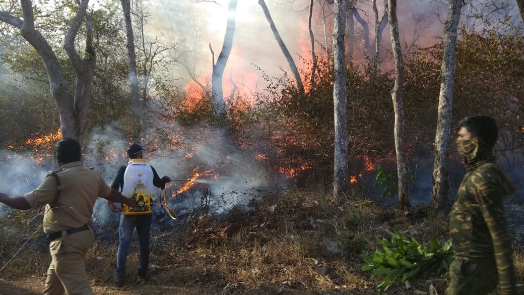
‘We Were Prepared For a Fire Accident'
Jayaram said that the department was prepared for a fire accident throughout the year. High wind speeds in the month of February, accompanied by high temperatures had troubled them while fighting the fire in the last few days.
“It was the wind speed that faltered us, in other countries it burns for months. They use helicopters while we fought it on the ground except on the last two days. Wind speed that is normally 5 km/hr increases to 10-20 km/hr in February, making the area more prone to forest fires. It was only because we were so organised that it was tackled.”C Jayaram to The Quint
Uncleared Dead Wood for 20 Years Made Matters Worse
Another factor that worsened the fire was the dead wood on the forest floor, uncleared for the last 20 years. The Supreme Court is yet to decide on permitting the same, as the belief is that the wood would help the forest ecosystem. “We are standing on a razor blade,” said Jayaram.
Report Shows Steady Intensification of Fire
As per the information provided in the report, fire affected areas increased in size from 21 ha on 23 February to 1808 ha the following day. Final estimation of fire-affected areas on 25 February, the last day the fire was active, was 4419 ha or 10,920 acres.
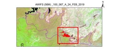
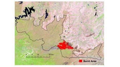
Using satellite data, burnt area assessment is performed on the basis of the tone, texture, shape and association of the burned patches and their spectral responses in different regions of the electromagnetic spectrum, said the report. The Burnt Area Index Method (BAIM) uses data from the charcoal signature of the burnt area.
Essential Business Intelligence, Sharp Market Insights, Practical Personal Finance Advice, Daily Fuel, Gold and Silver Prices and Latest Stories — On NDTV Profit.