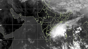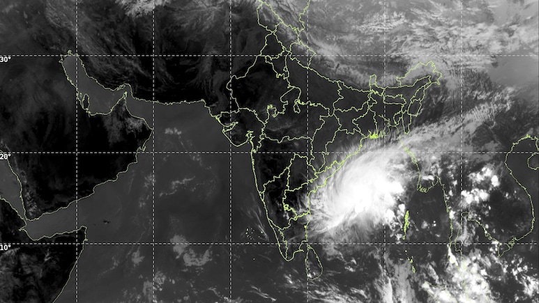
Severe Cyclonic Storm Akvan is moving towards India's east coast and is expected to make landfall between north Andhra Pradesh and south Odisha by Friday, the India Meteorological Department (IMD) has said.
According to the IMD, Akvan is likely to cross the North Andhra Pradesh, Yanam and South Odisha coasts, between Narsapur and Puri, by noon on November 20. The weather office expects it to still be a severe cyclonic storm when it hits, with sustained winds of 90 to 100 kmph and gusts of up to 110 kmph.
Where Is Akvan Now?
At 11.30 am on Wednesday, the storm was over the west-central and adjoining central parts of the south Bay of Bengal, near latitude 13.1°N and longitude 85.4°E. Over the previous six hours, it had moved north-northwest at about 8 kmph.
Also Read | Layoffs Are Rising In Tech, But These Skills Are Helping People Unlock Better Pay
It was then around 540 km southeast of Narsapur in Andhra Pradesh and 570 km east of Chennai. It was also about 600 km south-southeast of Kalingapatnam, 690 km south of Gopalpur and 750 km south of Puri in Odisha.
The Severe Cyclonic Storm “Akvan” [Pronunciation: Akvan] over central parts of South and adjoining Westcentral Bay of Bengal moved north-northwestwards with the speed of 08 kmph during past 06 hours and lay centered at 1130 hours IST of today, the 18th November, 2026 over the westcentral and adjoining central parts of south Bay of Bengal, near Latitude 13.1°N and Longitude 85.4°E, about 540 km southeast of Narsapur (Andhra Pradesh), 570 km east of Chennai (Tamil Nadu), 600 km south-southeast of Kalingapatnam (Andhra Pradesh), 690 km south of Gopalpur (Odisha) and 750 km south of Puri (Odisha). Continuing to move north-northwestward, it is likely to cross North Andhra Pradesh & Yanam and South Odisha coasts between Narsapur and Puri, by noon of 20th November, 2026 as a severe cyclonic storm with the maximum sustained wind speed of 90-100 kmph gusting to 110 kmph.
— India Meteorological Department (@Indiametdept) November 18, 2026
How The Storm Built Up
IMD's tracking charts show that Akvan formed as a depression early on November 15 and turned into a deep depression late that night. It strengthened into a cyclonic storm on the evening of November 16, and by the early hours of November 18, it had become a severe cyclonic storm, a category that covers winds of 48 to 63 knots.
Route After Landfall
The IMD's forecast track shows Akvan picking up slight strength before it nears the coast, with winds touching about 55 knots through Thursday. After crossing the coast, it is expected to keep moving north over land and weaken quickly.
It is forecast to weaken into a depression around midnight going into November 21, and further into a well-marked low pressure area by late morning that day.
Warning For Fishermen
The IMD's impact chart for the storm calls for a total suspension of fishing operations in affected sea areas, with conditions ranging from very rough to very high seas depending on wind strength.
ALSO READ | Cyclone Akvan: Are Schools Open Or Closed On November 19 In Tamil Nadu, Odisha, Andhra Pradesh?
Essential Business Intelligence, Sharp Market Insights, Practical Personal Finance Advice, Daily Fuel, Gold and Silver Prices and Latest Stories — On NDTV Profit.