Mumbai-Nagpur High-Speed Corridor: Ground Survey Conducted Through Laser Technique
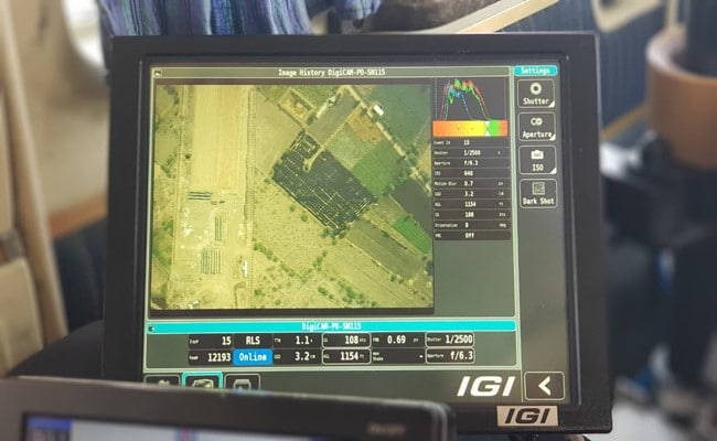
Mumbai-Nagpur High-Speed Rail Corridor: In order to conduct the ground survey for preparing the detailed project report (DPR) of the proposed Mumbai-Nagpur high-speed rail corridor, the light detection and ranging survey (LiDAR) was started on Friday, March 12, said the National High-Speed Rail Corporation Limited (NHSRCL). This was done to capture data related to ground survey for the 736 km long Mumbai-Nagpur rail corridor, where an airplane fitted with aerial LiDAR and imagery sensors took the first flight. (Also Read: Delhi-Varanasi High-Speed Corridor: Laser Technique Adopted For Ground Survey )
The National High-Speed Rail Corporation Limited, entrusted with the task of implementing the bullet train project, is adopting the light detection and ranging survey technology as it provides all ground details and data in three-four months, whereas this process usually takes 10-12 months by traditional survey methods.
LiDAR Survey for the Preparation of Detailed Project Report for Mumbai-Nagpur High Speed Rail Corridor has started today, where an aeroplane fitted with state of art Aerial LiDAR and Imagery sensors took the first flight and captured the data related to ground survey. #NHSRCL pic.twitter.com/wYOA58bHOq
March 12, 2021Mumbai-Nagpur High-Speed Rail Corridor - top features:
- The proposed plan for the approximately 736 km long Mumbai Nagpur high-speed rail corridor will connect Mumbai city with cities such as Nagpur, Wardha, Khapri Deport, Pulgoan, Malegaon Jahangir, KaranjaLad, Mehkar, Aurangabad, Jalna, Shirdi, Nashik, Shahapur, Igatpuri.
- According to NHSRCL, the ground survey is a crucial activity for any linear infrastructure project as the survey provides accurate details of areas around the alignment. The technique uses a combination of laser data, GPS data, flight parameters, as well as actual photographs to provide survey data.
- During the aerial LiDAR survey, 150 meters of the area around the proposed alignment is being captured for the survey purpose, according to NHSRCL.
- After the collection of data, three dimensional (3D) topographical map of the corridor of the proposed alignment on a scale of 1:2500 will be available for designing of the vertical and horizontal alignment, structures, location of the stations and depots, land requirement for the corridor, identification of project affected plots or structures etc.
- In order to provide clear pictures of the structures, trees, and other minute ground details, 100-megapixel cameras are being used for the LiDAR survey.
Due to its high accuracy, the aerial LiDAR survey technique was adopted for the very first time for the prioritized bullet train corridor - the Mumbai-Ahmedabad high-speed rail. This was the very first time when the method was utilized for any railway project in the country. The data provided through the LiDAR survey technique can be useful for vatrious projects including surface transport, roads, irrigation, landslides, canals, city planning, etc.NHSRCL has been entrusted with the task to prepare the detailed project reports for seven proposed high-speed rail corridors and LiDAR survey technique will be used for conducting ground surveys in all the corridors.

-
Getting To Work Costs Women More | The Reason Why

It is not just about women paying more than men. It is about women paying much more in cities than in villages.
-
AI Bias In Investing Cannot Be Eliminated, But It Can Be Governed
Framing is a particularly important example as identical financial information presented in terms of gains rather than losses can lead an LLM to reach a different assessment.
-
Joining The Dots | Dark Skies, Steady Diya: Why Hope Holds This Diwali
With war, a weak rupee and foreign outflows weighing on sentiment, policymakers at the NDTV World Summit and market veterans at NDTV Profit Ignite: Diwali Edition offered the same advice: stay invested and filter out the noise.
-
The Curious Case of Equitas Small Finance Bank And A CEO Who Quit For Stock
PN Vasudevan believes persistent investor concerns over a perceived conflict of interest had become a governance overhang on Equitas Small Finance Bank's stock, even as the lender improved profitability and asset quality.
-
Talking Points This Week: AI Cash Burn, A Tiger Comeback And An India That Still Finds Its Own Path
India is not immune to higher oil or tighter global liquidity, yet its earnings base is broader, its domestic policy levers are still available.
-
Foreign Investors Own Half Of HDFC Bank and ICICI Bank. An LTCG Cut Could Matter Most Here
Foreign portfolio investors have US$115 billion parked in HDFC Bank, ICICI Bank. If the government cuts long-term capital gains tax, Jefferies says returning foreign money could land here first.
-
'Never Seen This Level Of Negativity': Sandeep Tandon Says The Next Rally May Be Closer Than You Think
Veteran investor Sandeep Tandon says foreign selling is easing, large-caps are due a comeback and mid-caps are crowded, while he turns positive on gold, power and pharma this Diwali.
-
Indians Stay With Family, Not In Hotels | The Reason Why
India still lacks enough clean, reliable and affordable hotels for budget-conscious travellers.
-
The Economic Imperative: Analysing The Material Driving Force Behind India-Canada Strategic Reset
This economic complementarity is further reinforced by deep institutional investment ties and talent mobility, which form the bedrock of the bilateral framework.
-
Medicine Pricing: Where Must Profit Stop?
India must confront excessive margins, hidden incentives and regulatory gaps that threaten the integrity of medicine.